-

DJI Flighthub
With Pix4D the mapping of agricultural fields can be used, among other things, to carry out the early identification of pests and pests, the planning of… -

DJI TERRA
• Aerial Surveying & 3D Mapping • Construction Site Monitoring & Volume Calculation • Precision Agriculture & Crop Analysis • Disaster Response & Damage Assessment • nfrastructure & Utility Inspection… -

Pix 4D
With Pix4D the mapping of agricultural fields can be used, among other things, to carry out the early identification of pests and pests, the planning of… -

Terra Soild SOFTWARE FOR LIDAR PROCESSING
• LiDAR Surveying & Mapping • Infrastructure & Utility Inspection • Forestry & Environmental Monitoring • Mining & Quarry Management • Disaster Management & Damage Assessment • Urban Planning & Civil… -
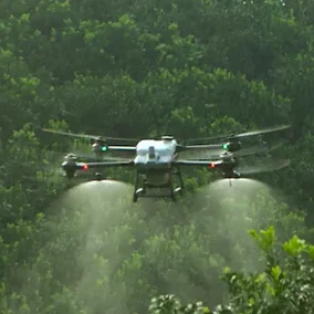
DJI AGRAS T40 (Agriculture Drone)
• Precision Crop Spraying & Fertilization • Large-Scale Field Coverage & • High-Power Spraying • Variable Rate Chemical & Fertilizer Application • Crop Health Monitoring & NDVI Mapping • Sustainable Farming… -
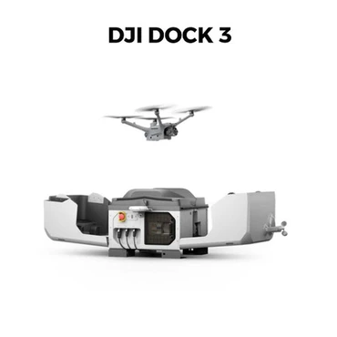
DJI Dock 3 – Rise to Any Challenge
The DJI Dock 3 is an advanced docking station for 24/7 autonomous drone operations. Waterproof (IP56), it offers fast recharging, precise RTK positioning and mobile compatibility… -
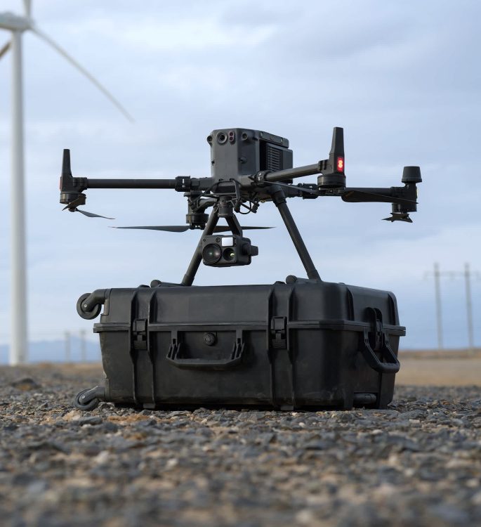
DJI Matrice 350 RTK
High-Precision Mapping: Matrice 350 RTK supports Waypoint, Mapping, Oblique, and Linear Flight missions. You can use Terrain Follow or Smart Oblique for efficient data collection. Together… -
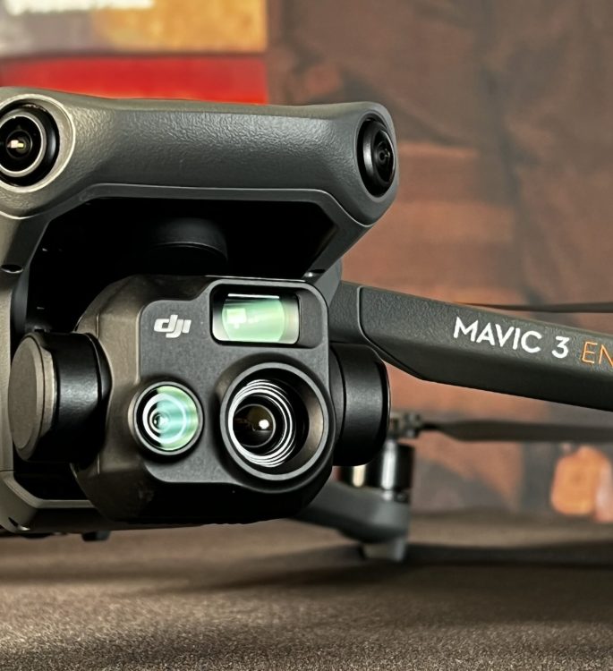
DJI MAVIC 3 ENTERPRISE SERIES
• Aerial Surveying & Mapping • Infrastructure & Utility Inspection • Search & Rescue & Public Safety • Precision Agriculture & Crop Health Monitoring • Security & Surveillance